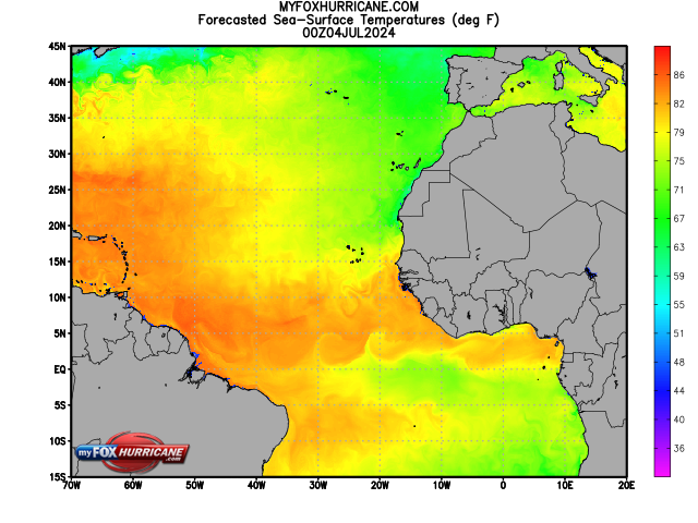
Forecasted Africa Sea Surface Temps

About this Map
RTOFS is an ocean forecast system based on the HYbrid Coordinate Ocean Model (HYCOM), which is a dynamical model. The model is run once a day. In meteorology and oceanography, the goal of dynamical models is to explain observed circulations on the basis of fundamental physical principles using complex mathematical equations. RTOFS specific goal is to establish high resolution short-term forecasts (approximately 1 week) of the ocean circulations, including eddies and currents. There is special emphasis on determining the location and strength of the Gulf Stream circulation.
One application of this model is to determine the path of objects embedded in the ocean such as the path of oil in an oil spill. Another application is to assist in hurricane strength forecasting. Water temperatures are higher in the Gulf Steam. If a hurricane is forecast to pass over the warmer Gulf Stream water, it could have a major impact on the strength of the hurricane. Knowing the exact location of currents such as the Gulf Stream and its associated warm and cold eddies is important information that can, in turn, be used in hurricane strength forecast models.
RTOFS produces nowcasts, as well as, forecasts of sea levels, ocean currents, temperatures and salinity. The model takes into account deep water and coastal waters. The image above is an analysis of sea surface temperatures. The Gulf Stream and its nearby eddies can be clearly seen swirling off the east coast. Warmer sea surface temperatures are depicted in red and cooler temperatures in blue and green.
Additional Weather Maps
-

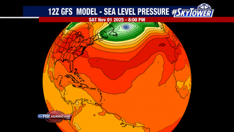
GFS Model | Atlantic
-
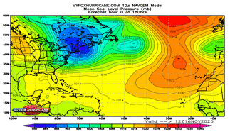
NAVGEM Model | Atlantic
-
WRF Atlantic Model
-
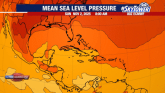
ECMWF Model | Caribbean

Storm Preparation Guide
county-by-county pages
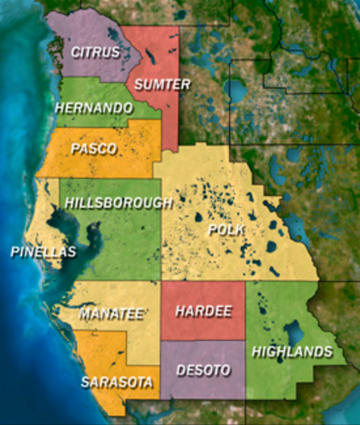 Click on your county above for specific evacuation zones, and emergency contacts.